


Technical Report 348, c4e-Preprint Series, Cambridge
Semantic specification of urban environmental exposure calculations within The World Avatar: a Singapore case study
Reference: Technical Report 348, c4e-Preprint Series, Cambridge, 2026
Associated Themes:

- Represents calculation methods and parameters separately from source datasets.
- Uses a common semantic model for raster, vector and attribute-based exposures.
- Links semantic calculation specifications to spatial execution in PostGIS.
- Retrieves exposures with their source data, temporal context and calculation choices.
- Generates traceable exposures for approximately 120,000 Singapore postal codes.
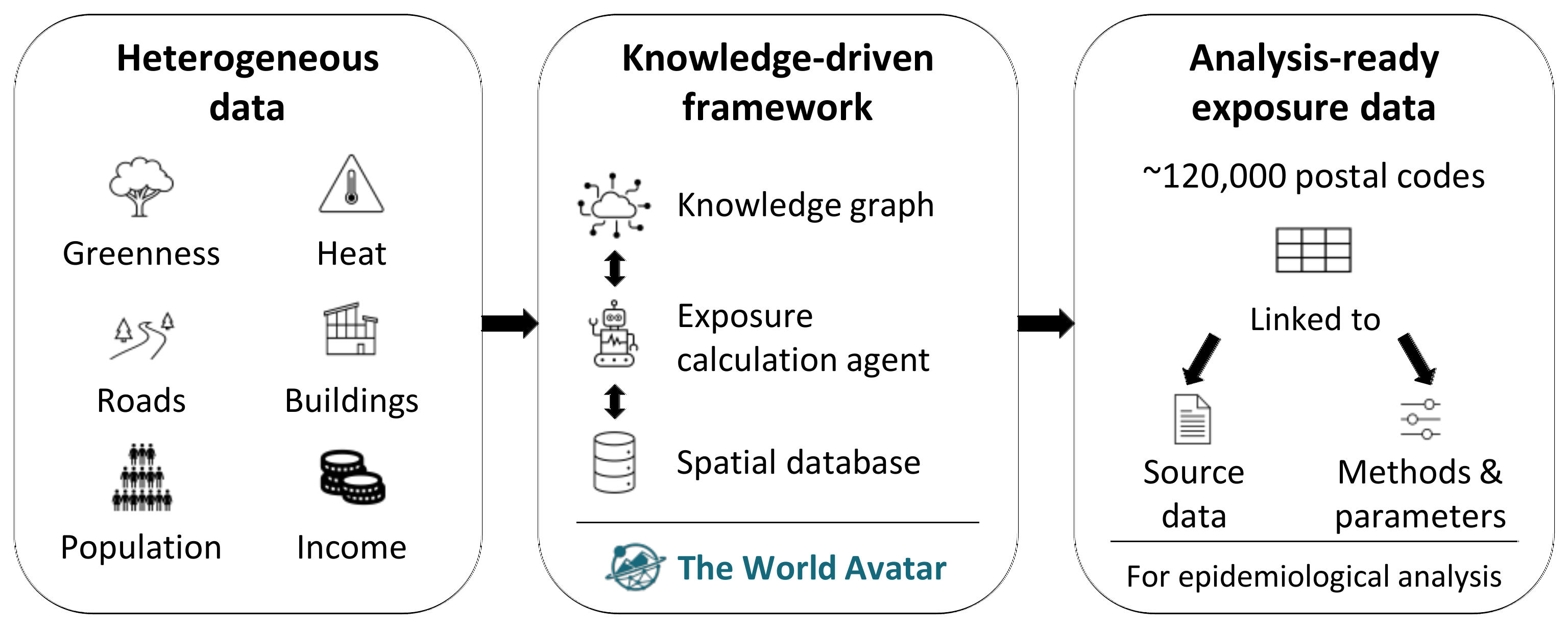 Health-data-driven urban design requires coherent environmental exposure measures for defined study locations at scale. However, assembling measures from datasets that differ in environmental domain, spatial form and temporal coverage often relies on scripts whose assumptions and provenance are difficult to recover. This study develops a framework for HD4, a programme funded by Singapore's National Research Foundation to link environmental exposures with population health outcomes. The framework uses a semantic model to represent calculation methods and parameters separately from source datasets, while a spatial database performs raster and vector operations. Each result remains linked to its study location, source data and calculation specification. Applied across approximately 120,000 Singapore postal-code locations, the framework generated physical and visual greenness, humid heat, urban morphology and socioeconomic measures. The case study demonstrates how these heterogeneous measures can be retrieved by exposure characteristics and temporal context, with each value traceable to its source data, calculation method and parameters.
PDF (13.3 MB)