


Technical Report 276, c4e-Preprint Series, Cambridge
Universal Digital Twin - Land Use
Reference: Technical Report 276, c4e-Preprint Series, Cambridge, 2021
Associated Themes:
![]()
- Developed formal ontologies to represent geospatial land use data.
- Applied to Crop Map of England data published by UK Government.
- Developed customised vocabulary to enable geospatial queries.
- Land use data incorporated into knowledge-graph-based Universal Digital Twin.
- Cross-domain use case that performs geospatial analysis of energy provision.
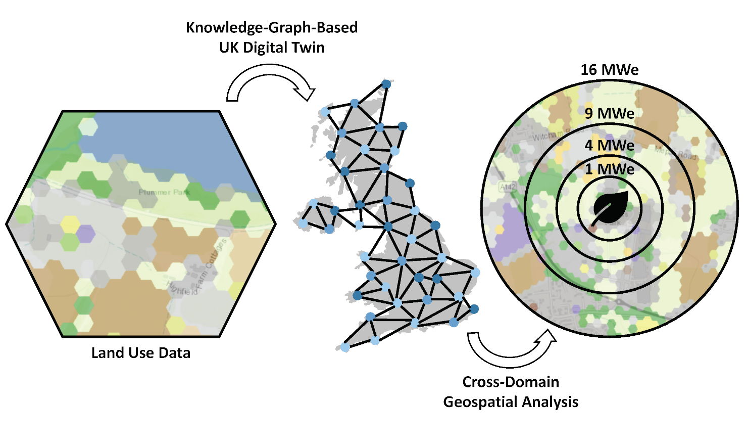 This paper develops an ontological description of land use and applies it to incorporate geospatial information describing land coverage into a knowledge-graph-based Universal Digital Twin. Sources of data relating to land use in the UK have been surveyed. The Crop Map of England (CROME) is produced annually by the UK Government and was identified as a valuable source of open data. Formal ontologies to represent land use and the geospatial data arising from such surveys have been developed. The ontologies have been deployed using a high-performance graph database. A customised vocabulary was developed to extend the geospatial capabilities of the graph database to support the CROME data. The integration of the CROME data into the Universal Digital Twin is demonstrated in a cross-domain use case that combines data about land use with a geospatial analysis of scenarios for energy provision. Opportunities for the extension and enrichment of the ontologies, and further development of the Universal Digital Twin are discussed.
Material from this preprint has been published in Data-Centric Engineering.
PDF (13.0 MB)